Tropical Storm Elsa moving through NC

This graphic shows an approximate representation of coastal areas under a hurricane warning (red), hurricane watch (pink), tropical storm warning (blue) and tropical storm watch (yellow). The orange circle indicates the current position of the center of the tropical cyclone. The black line, when selected, and dots show the National Hurricane Center (NHC) forecast track of the center at the times indicated. The dot indicating the forecast center location will be black if the cyclone is forecast to be tropical and will be white with a black outline if the cyclone is forecast to be extratropical. If only an L is displayed, then the system is forecast to be a remnant low. The letter inside the dot indicates the NHC's forecast intensity for that time.
This graphic is created by the NWS/NCEP Weather Prediction Center (WPC) and shows rainfall potential for the United States when a tropical cyclone threatens land. The graphic is displayed as a Quantitative Precipitation Forecast (QPF), which shows rainfall totals for a specified time period, based on forecaster discretion.

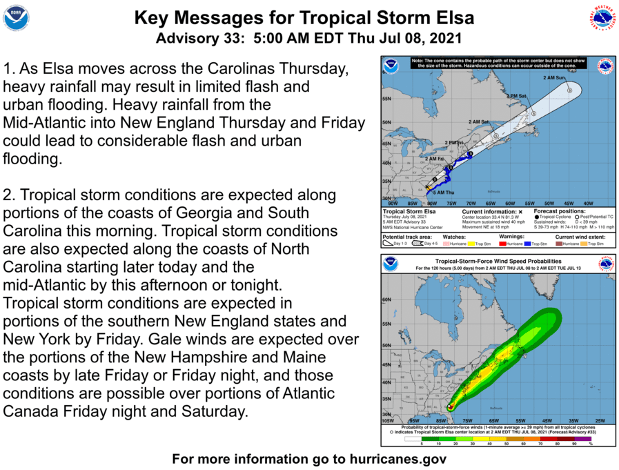
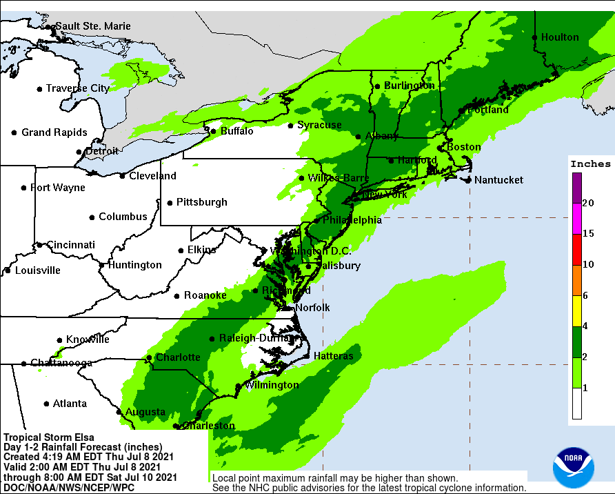
RALEIGH – Tropical Storm Elsa is expected to remain a tropical storm as it moves through North Carolina today, according to the National Hurricane Center. Main impacts will occur over central and eastern North Carolina. The main effects on North Carolina will be heavy rainfall and possible flooding, and there is also a risk of an isolated tornado mainly east of Highway 1.

Key messages from the National Hurricane Center regarding Tropical Storm Elsa.